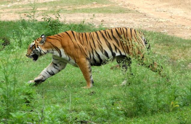
 Tiger-tracking and wildlife conservation have a new mobile application for vigorous monitoring and better coordination of anti-poaching camp personnel at Bandipur.
For, “Hejje” (Pug mark), an indigenously developed Android-based application, was launched at Bandipur on Monday. It will help coordinate foot patrolling of forest staff apart from providing the range forest officers live update of their respective anti-poaching patrolling activities such as patrol time, water level in lakes, suspicious activities, tree population and forest fires.
The application, launched by Conservator of Forests and Director of Bandipur Tiger Reserve H.C. Kantharaj, has been developed by KeyFalcon Solutions of Bangalore.
Tigers in Bandipur, a prime tiger habitat, are vulnerable to poaching. Effective protection of this habitat calls for modernisation, and the induction of “Hejje” adds a new protocol to the monitoring system, according to Mr. Kantharaj.
The staff using the mobile application can take photographs and the application will instantly deliver it to the headquarters where senior officials can take decisions based on real-time information relayed from the ground.
In case of depletion of water levels, a study of a series of images taken from the field can help assess the gravity of the situation, Mr. Kantharaj said.
“Hejje” will be used by the anti-poaching camp staff during their routine patrolling and range forest officers would get real-time updates of patrol start time, end time, distance covered and animal sighted. The data is encrypted and hence, secured and information will be accessible only to authorised staff.
D. Rajkumar, Honorary Warden of Mysore District, told The Hindu that the application will be downloaded to 40 phones that will be handed over to the Bandipur Tiger Reserve staff and each anti-poaching camp will have one such device, he added.
Underlining the benefits of the application, Mr. Kantharaj said that tiger movement along the fringes can be detected by alert mechanism that will help take proactive steps as even pug marks and animal paths can be monitored by just taking a photograph and downloading it with the GPS location.
Water holes can be monitored for levels and forest fires can be recorded and regular real-time maps can be generated which will help map fire-prone areas. The software can be used to alert officials of forest fires through notifications, Mr. Kantharaj added.
The adjoining BRT Wildlife Sanctuary makes use of a similar application called “Huli”