 Bangalore, June 21;The Great Trigonometric Survey of the 1800s, one of the most ambitious projects undertaken to map India, has an unexpected association with a small village near Koramangala.
Agaram, according to historical literature, was the southern end of the baseline for this exercise, which culminated in the ‘Great Indian Arc of the Meridian’, advancing our scientific understanding of the exact curvature of the earth.
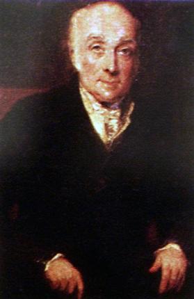
The man whose idea it was for this feat, which took nearly 50 years to complete and went on to prove that Mt. Everest, not one in the Andes, was the highest mountain in the world, was Lieutenant Colonel William Lambton (1753-1823).
To measure 2,250 km from this baseline up to the foothills of the Himalayas was of course technically extraordinary, and physically dangerous, two centuries ago. The surveyors used a 100-ft chain that would have had to be carried in sections in five wooden chests not to mention the theodolite (a kind of telescope/survey instrument) that weighed half a tonne.
The theodolite would have to be placed at a height, perhaps on temple gopuras or on specially built towers if nothing else was available, to carry out a series of ‘triangulations’ to measure the length of a latitudinal degree.
Dangerous quest
In 1796, Lambton had been sent to India under the command of Colonel Arthur Wesley. After the Anglo-Mysore wars, Lambton was asked to assist another surveyor, Captain Colin Mackenzie, in the Mysore Survey to map the newly acquired territories.
Lambton’s interest however went beyond the commercial and military. He was passionate about finding answers to the exact shape of the earth, a much debated subject of the time.
At great human cost, facing dangers of wild animals, disease and monsoon-swollen rivers, a team completed the survey that would form the framework for the survey of India.
Man and mountain
Unfortunately, Lambton did not live to see this.
It was his assistant, George Everest, who completed the task and so, despite Everest’s objections, the great mountain is named after him.
Admirable spirit
This experiment “established the earth was like an apple shape”, Vijay Thiruvady of Lalbagh Walks, explains. The Great Arc, he said, was an extraordinary feat, “an inch perfect survey of India” that meant Lambton would often disappear for years at a time into the jungles. “We owe them so much,” says Mr. Thiruvady. “Not just the knowledge they brought back, but their spirit of adventure”.